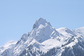
Tschaggunser Mittagspitze
Appearance
| Tschaggunser Mittagsspitze | |
|---|---|
 Tschaggunser Mittagsspitze in winter | |
| Highest point | |
| Elevation | 2,168 m (7,113 ft) |
| Coordinates | 47°2′45″N 9°53′6″E / 47.04583°N 9.88500°E |
| Geography | |
| Location | Vorarlberg, Austria |
| Parent range | Rätikon, Central Eastern Alps |
The Tschaggunser Mittagsspitze is a 2,168 m (AA) high mountain in the Rätikon mountain range of the Central Eastern Alps. It is located in the Austrian state Vorarlberg, south of the village Tschagguns in the Montafon valley.
Etymology
[edit]The name of Tschaggunser Mittagsspitze may be traced to "peak ("-spitze") above which the sun culminates at noon ("Mittag-") as seen from Tschagguns".[citation needed]
Further reading
[edit]- Flaig, Günther (1982). Rätikon : ein Führer für Täler, Hütten und Berge. München: R. Rother. ISBN 3763312366.
Wikimedia Commons has media related to Tschaggunser Mittagspitze.

