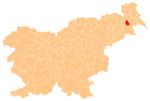
Boreci
Appearance
Boreci | |
|---|---|
| Coordinates: 46°33′29.47″N 16°8′13.44″E / 46.5581861°N 16.1370667°E | |
| Country | |
| Traditional region | Styria |
| Statistical region | Mura |
| Municipality | Križevci |
| Area | |
| • Total | 3.05 km2 (1.18 sq mi) |
| Elevation | 181.8 m (596.5 ft) |
| Population (2002) | |
| • Total | 286 |
| [1] | |
Boreci (pronounced [bɔˈɾeːtsi]) is a village in the Municipality of Križevci in northeastern Slovenia. Traditionally the area was part of Styria and is now included in the Mura Statistical Region.[2]
The village chapel with a belfry was built in 1903 in the Neo-Romanesque style.[3]
References
- ^ Statistical Office of the Republic of Slovenia
- ^ Križevci municipal site Archived 2008-09-24 at the Wayback Machine
- ^ Slovenian Ministry of Culture register of national heritage reference number ešd 20003
External links


