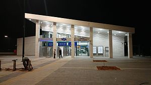
Netanya Sapir railway station
Netanya Sapir railway station תחנת הרכבת נתניה ספיר | |
|---|---|
| Israel Railways | |
 | |
| General information | |
| Location | Yad Harutzim 13, Netanya |
| Coordinates | 32°16′49″N 34°51′54″E / 32.28028°N 34.86500°E |
| Platforms | 2 |
| Tracks | 2 |
| Construction | |
| Parking | 283 spaces |
| Bicycle facilities | 34 spaces |
| Accessible | Yes |
| History | |
| Opened | 5 November 2016 |
| Electrified | no |
Netanya Sapir railway station (Hebrew: תחנת הרכבת נתניה ספיר, Taḥanat HaRakevet Netanya Sapir) is an Israel Railways station located in the Sapir (more commonly known as Poleg) commercial/industrial zone in southern Netanya, on the North-South coastal line.
| Preceding station | Israel Railways | Following station | ||
|---|---|---|---|---|
| Netanya towards Binyamina |
style="background:#Template:Israel Rail color; color:inherit; border-left: 0px none; border-right: 0px none; border-top:1px #aaa solid; border-bottom:0px none;" | | Binyamina–Ashkelon line Suburban Service |
style="background:#Template:Israel Rail color; color:inherit; border-left: 0px none; border-right: 0px none; border-top:1px #aaa solid; border-bottom:0px none;" | | Beit Yehoshua towards Rehovot or Ashkelon |
External links
