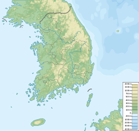
Huiyangsan
Appearance
| Heiyangsan | |
|---|---|
| Highest point | |
| Elevation | 998 m (3,274 ft) |
| Coordinates | 36°42′58″N 128°00′18″E / 36.716°N 128.005°E |
| Geography | |
| Location | North Gyeongsang Province, South Korea |
| Huiyangsan | |
| Hangul | |
|---|---|
| Hanja | |
| Revised Romanization | Hui-yangsan |
| McCune–Reischauer | Hŭiyangsan |
Heiyangsan is a mountain in North Gyeongsang Province, South Korea. It has an elevation of 998 metres.[1]
See also
References
- ^ An Gyeong-ho (2007). 한국 300 명산 (300 Korean Mountains). Seoul: 깊은솔 (Gipeunsol). ISBN 978-89-89917-21-2.

