Svilaj
Appearance
Svilaj | |
|---|---|
village | |
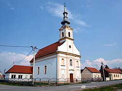
 Church at Svilaj | |
 | |
| Country | Croatia |
| County | Brod-Posavina |
| Population (2011) | |
• Total | 285 |
| Time zone | UTC+1 (CET) |
| • Summer (DST) | UTC+2 (CEST) |
| Postal code | 35213 Oprisavci |
| Area code | 035 |
Svilaj is a settlement (naselje) in the Croatian municipality of Oprisavci (Brod–Posavina County). According to the 2001 census, the settlement has 290 inhabitants.[1] Svilaj's importance lies in the planned border checkpoint and a bridge over the nearby Sava River, which will bear the internationally important freeway Pan-European Corridor Vc.[2]
See also
References
- ^ "Population by sex and age, by settlements, census 2001 (Oprisavci)". Republic of Croatia Bureau of Statistics. Retrieved 2009-04-12.
- ^ "Motorway on Corridor Vc: Pre-feasibility study" (PDF). IPSA Institute. October 2005. Retrieved 2009-04-12.
45°7′28″N 18°17′52″E / 45.12444°N 18.29778°E
Wikimedia Commons has media related to Svilaj.
