Buota
Appearance
1°36′00″N 173°00′00″W / 1.60000°N 173.00000°W

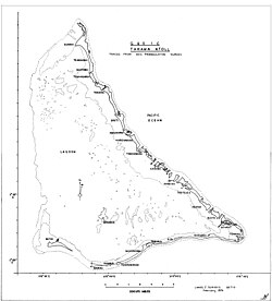
Buota is a settlement on the island of Tarawa, Kiribati.[1]
Education
Taunibong School in Buota serves as the elementary school. The area junior high school is Takoronga School in Terikiai, and the area senior high school is Tabiteuea North Senior Secondary School a.k.a. Teabike College in Eita.[2]
References
- ^ "South Tarawa Island Report 2012". Government of Kiribati.
- ^ "TABITEUEA NORTH 2008 Socio-Economic Profile" Part 2 of 4. Strengthening Decentralized Governance in Kiribati Project , Ministry of Internal and Social Affairs (Kiribati). p. 42 (PDF p. 7/15). Part 1 is here.
