
Barnstädt
Barnstädt | |
|---|---|
Location of Barnstädt within Saalekreis district 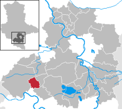 | |
 Barnstädt  Barnstädt | |
| Coordinates: 51°21′0″N 11°39′0″E / 51.35000°N 11.65000°E | |
| Country | Germany |
| State | Saxony-Anhalt |
| District | Saalekreis |
| Municipal assoc. | Weida-Land |
| Government | |
| • Mayor | Otto Weber |
| Area | |
| • Total | 18.21 km2 (7.03 sq mi) |
| Elevation | 206 m (676 ft) |
| Population (2022-12-31)[1] | |
| • Total | 966 |
| • Density | 53/km2 (140/sq mi) |
| Time zone | UTC+01:00 (CET) |
| • Summer (DST) | UTC+02:00 (CEST) |
| Postal codes | 06268 |
| Dialling codes | 034771 |
| Vehicle registration | SK |
Barnstädt is a municipality in the Saalekreis district, Saxony-Anhalt, Germany. It is a member of the Verbandsgemeinde Weida-Land.
References
- ^ "Bevölkerung der Gemeinden – Stand: 31. Dezember 2022" (PDF) (in German). Statistisches Landesamt Sachsen-Anhalt. June 2023.
Towns and municipalities in the district of Saalekreis | ||
|---|---|---|
 | ||
| International | |
|---|---|
| National | |
This Saalekreis location article is a stub. You can help Wikipedia by expanding it. |