
Friemar
Friemar | |
|---|---|
Location of Friemar within Gotha district 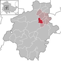 | |
 Friemar  Friemar | |
| Coordinates: 50°59′0″N 10°47′0″E / 50.98333°N 10.78333°E | |
| Country | Germany |
| State | Thuringia |
| District | Gotha |
| Municipal assoc. | Nesseaue |
| Area | |
| • Total | 9.37 km2 (3.62 sq mi) |
| Elevation | 285 m (935 ft) |
| Population (2022-12-31)[1] | |
| • Total | 991 |
| • Density | 110/km2 (270/sq mi) |
| Time zone | UTC+01:00 (CET) |
| • Summer (DST) | UTC+02:00 (CEST) |
| Postal codes | 99869 |
| Dialling codes | 036258 |
| Vehicle registration | GTH |
Friemar is a municipality in the district of Gotha, in Thuringia, Germany.

References
| International | |
|---|---|
| National | |
This Gotha district location article is a stub. You can help Wikipedia by expanding it. |