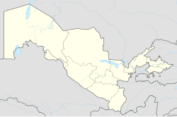
Aqmangit
Appearance
Oqmang‘it | |
|---|---|
Town | |
| Coordinates: 42°36′N 59°32′E / 42.600°N 59.533°E | |
| Country | |
| Autonomous Republic | Karakalpakstan |
| District | Nukus District |
| Population (2000) | |
| • Total | 8 100 |
| Time zone | UTC+5 (UZT) |
Oqmang‘it (Uzbek: Oqmang‘it, Karakalpak: Aqmańǵıt, Russian: Акмангит) is a town and seat of Nukus District in Karakalpakstan in Uzbekistan.The town population in 1989 year was 6169 people.[1]
References


