Jump to content

Jõelähtme

Coordinates: 59°26.5′N 25°08′E / 59.4417°N 25.133°E / 59.4417; 25.133
From Wikipedia, the free encyclopedia

This is an old revision of this page, as edited by 2001:7d0:81f7:b580:b549:5a05:bbd:f440 (talk) at 09:01, 19 October 2018 (rm data that is about Jõelähtme Parish, not the village). The present address (URL) is a permanent link to this revision, which may differ significantly from the current revision.

Jõelähtme
Village
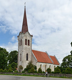
Jõelähtme church
Jõelähtme church
Map
Country Estonia
CountyHarju County
ParishJõelähtme Parish
Population
 (2011)
 • Total
120
Time zoneUTC+2 (EET)
 • Summer (DST)UTC+3 (EEST)

Jõelähtme (Template:Lang-de) is a village in Jõelähtme Parish, Harju County, northern Estonia.

59°26.5′N 25°08′E / 59.4417°N 25.133°E / 59.4417; 25.133