
La Crosse West Channel Bridge
La Crosse West Channel Bridge | |
|---|---|
 | |
| Coordinates | 43°49′7.3″N 91°16′22.6″W / 43.818694°N 91.272944°W |
| Carries | 4 lanes of |
| Crosses | Mississippi River |
| Locale | La Crosse, Wisconsin, to La Crescent, Minnesota |
| Maintained by | Wisconsin and Minnesota Departments of Transportation |
| Characteristics | |
| Design | Plate girder bridge |
| Statistics | |
| Daily traffic | 15,100 |
| Location | |
 | |
The La Crosse West Channel Bridge is a plate girder bridge that spans the west channel of the Mississippi River between Barron Island in Wisconsin, and La Crescent, MN. Together with the Mississippi River Bridge it forms a connection between La Crescent and downtown La Crosse, Wisconsin. The Mississippi River Bridge carries U.S. Routes 14 and 61, and forms the eastern terminus of MN-16 and the western terminus of WI 16.
Photo gallery
-
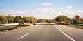 La Crosse West Channel Bridge from the road

See also
Crossings of the Mississippi River | ||||
|---|---|---|---|---|
| ||||
This article about a bridge in Minnesota is a stub. You can help Wikipedia by expanding it. |
This article about a bridge in Wisconsin is a stub. You can help Wikipedia by expanding it. |
Categories:
- Road bridges in Minnesota
- Bridges over the Mississippi River
- Road bridges in Wisconsin
- U.S. Route 14
- U.S. Route 61
- Bridges on the United States Numbered Highways
- Plate girder bridges in the United States
- Buildings and structures in La Crosse, Wisconsin
- Buildings and structures in Houston County, Minnesota
- Interstate vehicle bridges in the United States
- Midwestern United States bridge (structure) stubs
- Minnesota building and structure stubs
- Minnesota transportation stubs
- Wisconsin building and structure stubs
- Wisconsin transportation stubs