Agabar
Appearance
Agabar | |
|---|---|
Town | |
| Coordinates: 9°55′N 43°55′E / 9.917°N 43.917°E | |
| Country | |
| Region | Woqooyi Galbeed |
| District | Gabiley District |
| Time zone | UTC+3 (EAT) |
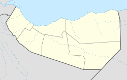
Agabar is a sizeable town which is part of Woqooyi Galbeed region of Somaliland. It is located in the northeastern side of Gabiley District.[1]
Demographics
The total population of Agabar is 6,547 and is primarily inhabited by people from the Somali ethnic group, with the Adan Jibril (Bahabar Adan) sub-clan of the Jibril Abokor sub-division of the Habr Awal the traditional residents of this town.[2]
References
- ^ "Agabar Map — Satellite Images of Agabar". maplandia.com.
- ^ Immigration and Refugee Board of Canada, Somalia: Information on the ethnic composition in Gabiley (Gebiley) in 1987–1988, 1 April 1996, SOM23518.E [accessed 6 October 2009]

