Steensel
Appearance
Steensel | |
|---|---|
 | |
| Country | |
| Province | |
| Municipality | |
| Population (1 January 2007) | |
• Total | 1.376 |
| Source: CBS, Statline. | |
| Time zone | UTC+1 (CET) |
| • Summer (DST) | UTC+2 (CEST) |
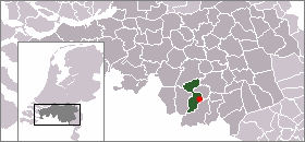
Steensel is a village on the Gender stream in the municipality of Eersel, North Brabant, the Netherlands. Steensel is part of the Acht Zaligheden (Eight Delights), along with Eersel, Knegsel, Duizel, Wintelre, Netersel, Hulsel en Reusel. In 2007, Steensel had 1,376 inhabitants.
The name Steensel appeared first in a document from 1224, in which a certain Henricus and Marcelis were mentioned as knights of Steensel. In 1688, Steensel was plundered and destroyed by French soldiers. In 1810, Steensel became part of the municipality of Duizel and Steensel. In 1922, this municipality then merged into the municipality of Eersel.

|

|

|

|
51°23′N 5°21′E / 51.383°N 5.350°E
