Upamaka
Appearance
Upamaka
Upmaka agraharam | |
|---|---|
village | |
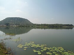
 View of Upamaka cave temple hill near Nakkapalli | |
| Coordinates: 17°23′51″N 82°42′57″E / 17.39750°N 82.71583°E | |
| Country | |
| State | Andhra Pradesh |
| Government | |
| • Body | Upmaka grama Panchayat |
| Area | |
| • Total | 6 kilometres around km2 (Formatting error: invalid input when rounding sq mi) |
| Population | |
| • Total | 3,656 |
| Languages | |
| • Official | Telugu |
| Time zone | UTC+5:30 (IST) |
| Website | Www. Upmaka Balaji.com |
Upamaka is a village in Nakkapalle mandal of Visakhapatnam district of Andhra Pradesh in India, where an ancient temple of Lord Venkateswara Swamy is present. Upamaka, is a small village very much like a Minnow.
External links
• www.upamakabalaji com


