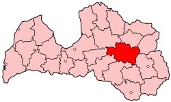
Madona District
Appearance
Madona | |
|---|---|
District | |
 | |
| Country | Latvia |
| Area | |
• Total | 3,349.3 km2 (1,293.2 sq mi) |
| Population | |
• Total | 44,306 |
| • Density | 13/km2 (34/sq mi) |
| Website | madona.lv/ |
Madona District (Template:Lang-lv) was an administrative division of Latvia, located in Vidzeme and Latgale regions, in the country's east. Within the district is the highest point in Latvia - Gaiziņkalns. The district also bordered Latvia's largest lake, Lake Lubāns.
Districts were eliminated during the administrative-territorial reform in 2009.
