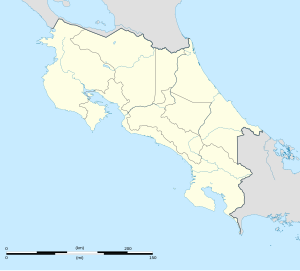
Montezuma, Costa Rica
Montezuma | |
|---|---|
 Montezuma Falls | |
| Coordinates: 9°39′N 85°04′W / 9.650°N 85.067°W | |
| Country | |
| Province | Puntarenas |
| Time zone | UTC-6 |
| Area code | +506 |
Montezuma is a town in Puntarenas Province, Costa Rica which began as a remote fishing village and has gained popularity since the 1980s among tourists on a budget.
Montezuma is located near the southern tip of the Nicoya Peninsula, 41 km (25 mi) southwest of Paquera and 8 km (5 mi) south of the town of Cóbano. Most services are in Cóbano. The nearest airport is located in Tambor.[1]
The town features a mix of local residents as well as foreign backpackers and eco-tourists who come for the beaches, rivers, and scenic waterfalls that surround the village. The nearby Cabo Blanco Nature Reserve draws a large number of visitors to the area.

Further reading
Wikivoyage has a travel guide for Montezuma.
- Lonely Planet Costa Rica ISBN 1-74059-118-6
- B&B Map Costa Rica Road Map ISBN 3-89707-510-5
- "the Montezuma map and guide"—available free from the downtown Tropisphere Real Estate Montezuma centro office

