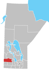
Rolling River First Nation
Appearance
The Rolling River First Nation has a total registered population of just under 1000 band members. About half of the members are resident on the First Nation reserves which are located south and east of Erickson, Manitoba. Band #291 are in possession of three reserves. The main reserve (Rolling River 67) is bordered mostly by the Rural Municipality of Harrison, but also has a significant border with the Rural Municipality of Clanwilliam, plus a much smaller border with the Rural Municipality of Minto.

