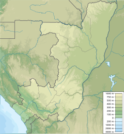
Lake Mboukou
Appearance
| Lake Mboukou | |
|---|---|
| Lac Mboukou Error {{native name checker}}: parameter value is malformed (help) | |
| Location | Republic of the Congo |
| Coordinates | 0°57′N 17°22′E / 0.950°N 17.367°E |
| Basin countries | Republic of the Congo |
| Max. length | 1.4 km (0.87 mi) |
| Max. width | 0.6 km (0.37 mi) |
| Surface elevation | 312 m (1,024 ft) |
Lake Mboukou (French: Lac Mboukou) is a freshwater lake in Epena District, Republic of the Congo.[1]
Description
It is a small lake located roughly 50 km to the southeast from Lake Tele at 0°57′5″N 17°22′45″E / 0.95139°N 17.37917°E in the north-eastern area of the Republic of the Congo. Lake Mboukou is almost totally surrounded by forest except in its SW shore where the village of Mboukou is located.
Local significance
The 1996 book Congo Journey, by the British travel writer Redmond O'Hanlon, mentions this lake as a place with strong spirits according to the local people.
Ecology
This lake belongs to the 4,389.6 km2 (1,694.8 sq mi) wetland area of the Réserve Communautaire du Lac Télé/Likouala-aux-Herbes. It is a Ramsar site since 18 July 1998.[2]
References
External links

