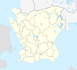
Gislövs läge och Simremarken
Appearance
Gislövs läge och Simremarken | |
|---|---|
| Coordinates: 55°21′N 13°14′E / 55.350°N 13.233°E | |
| Country | Sweden |
| Province | Skåne |
| County | Skåne County |
| Municipality | Trelleborg Municipality |
| Area | |
• Total | 1.47 km2 (0.57 sq mi) |
| Population (2005-12-31)[1] | |
• Total | 1,462 |
| • Density | 993/km2 (2,570/sq mi) |
| Time zone | UTC+1 (CET) |
| • Summer (DST) | UTC+2 (CEST) |
Gislövs läge och Simremarken was a village situated in Trelleborg Municipality, Skåne County, Sweden with 1,462 inhabitants in 2005.[1]
It has since 2010 grown to be a joint part of the greater development of Trelleborg. There no longer exists an official development unit by this name.[2]
References
- ^ a b c "Tätorternas landareal, folkmängd och invånare per km2 2000 och 2005" (xls) (in Swedish). Statistics Sweden. Retrieved 2009-05-07.
- ^ "Sveriges tätorter 2010" (PDF). SCB. Archived from the original (PDF) on 18 June 2011. Retrieved 16 June 2011.


