Anse Figuier, les Saintes
Anse Figuier | |
|---|---|
Quartier | |
 | |
| Coordinates: 15°51′33″N 61°35′11″W / 15.85917°N 61.58639°W | |
| Country | |
| Overseas department | |
| Canton | les Saintes |
| commune | Terre-de-Haut |
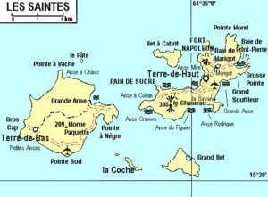
Anse Figuier is a quartier of Terre-de-Haut Island, located in Îles des Saintes archipelago in the Caribbean. Located in the Southern part of the island, it is built around a golden sandy beach called Anse Figuier.
