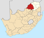
Roedtan
Roedtan | |
|---|---|
| Coordinates: 24°35′54″S 29°04′50″E / 24.59833°S 29.08056°E | |
| Country | South Africa |
| Province | Limpopo |
| District | Waterberg |
| Municipality | Mookgopong |
| Area | |
| • Total | 1.00 km2 (0.39 sq mi) |
| Population (2011)[1] | |
| • Total | 98 |
| • Density | 98/km2 (250/sq mi) |
| Racial makeup (2011) | |
| • Black African | 83.7% |
| • White | 16.3% |
| First languages (2011) | |
| • Northern Sotho | 41.7% |
| • Tsonga | 20.8% |
| • English | 13.5% |
| • Afrikaans | 11.5% |
| • Other | 12.5% |
| Time zone | UTC+2 (SAST) |
| PO box | 0580 |
| Area code | 015 |
Roedtan is a small town in the Limpopo province, South Africa, set in the midst of the Springbok Flats. Roedtan has a rail road station 85 km (53 mi) from Polokwane. At the road junction to Roedtan stands a monument to the battle of Moordrift in 1854 when 33 white people (descendants mainly of Dutch settlers from the 17th and 18th centuries who had moved north from the Cape Colony to escape what they saw as oppressive rule by the British colonial government - such as having to give up their slaves (and, worse, having to co-exist with them on equal terms) in line with the legislated emancipation of all slaves in the British Empire in 1833) were killed in a skirmish with the local tribe headed by Makapane. The cave, Makapansgat, is now known to record early hominid occupation (1,500,000 years ago) and is a national monument. The Springbok Flats is a reminder that great herds of Springbok once populated the plain, which was also frequented by lions and other wild animals.
References
- ^ a b c d "Main Place Roedtan". Census 2011.


