
Samborowice, Silesian Voivodeship
Samborowice | |
|---|---|
Village | |
,_chodn%C3%ADk_II.jpg) Street | |
 Samborowice | |
| Coordinates: 50°3′N 18°7′E / 50.050°N 18.117°E | |
| Country | |
| Voivodeship | Silesian |
| County | Racibórz |
| Gmina | Pietrowice Wielkie |
| Population | 720 |
Samborowice [sambɔrɔˈvit͡sɛ] (German: Schammerwitz) is a village in the administrative district of Gmina Pietrowice Wielkie, within Racibórz County, Silesian Voivodeship, in southern Poland, close to the Czech border.[1] It lies approximately 5 kilometres (3 mi) south-east of Pietrowice Wielkie, 10 km (6 mi) south-west of Racibórz, and 67 km (42 mi) west of the regional capital Katowice.
The village has a population of 720.
Gallery
-
 Railroa
 -
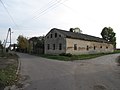 House
House -
 House
House
,_koleje.jpg)
,_d%C5%AFm.jpg)
,_d%C5%AFm_II.jpg)
References
Wikimedia Commons has media related to Samborowice, Silesian Voivodeship.
| Seat |  | |
|---|---|---|
| Other villages | ||
This Racibórz County location article is a stub. You can help Wikipedia by expanding it. |