
Grabówka, Kędzierzyn-Koźle County
Grabówka | |
|---|---|
Village | |
,_ulice_III.jpg) Street | |
 Grabówka | |
| Coordinates: 50°16′50″N 18°16′27″E / 50.28056°N 18.27417°E | |
| Country | |
| Voivodeship | Opole |
| County | Kędzierzyn-Koźle |
| Gmina | Bierawa |
| Population | 216 |
Grabówka [ɡraˈbufka] (German: Sackenhoym) is a village in the administrative district of Gmina Bierawa, within Kędzierzyn-Koźle County, Opole Voivodeship, in south-western Poland.[1] It lies approximately 3 kilometres (2 mi) east of Bierawa, 10 km (6 mi) south-east of Kędzierzyn-Koźle, and 50 km (31 mi) south-east of the regional capital Opole.
Before 1945 the area was part of Germany (see Territorial changes of Poland after World War II).
The village has a population of 216.
Gallery
-
 Street
 -

-
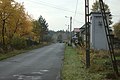 Road
Road
,_ulice_II.jpg)
,_plot.jpg)

References
| Seat |  | |
|---|---|---|
| Other villages | ||
50°16′50″N 18°16′27″E / 50.28056°N 18.27417°E
This Kędzierzyn-Koźle County location article is a stub. You can help Wikipedia by expanding it. |