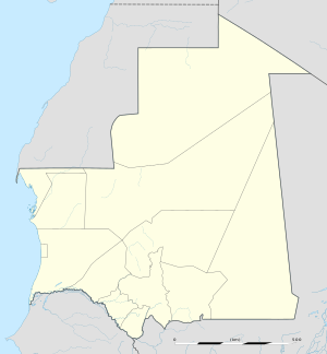
Moudjeria
Moudjeria | |
|---|---|
Commune and town | |
| Coordinates: 17°52′50″N 12°19′55″W / 17.88056°N 12.33194°W | |
| Country | |
| Region | Tagant |
| Elevation | 495 ft (151 m) |
| Population (2007)[1] | |
| • Total | 40,974 |
| Time zone | UTC+0 (GMT) |
Moudjeria is a town and commune in the Tagant Region of southern-central Mauritania.[2]
Temperatures during the summer are among the highest in the world and can easily exceed 55° Celsius (131° Fahrenheit).
History
In 1934 Moudjeria was founded as an administrative post by the French.[3]
Transport
The town is served by Letfotar Airport.
Notable people
- Hamadi Ould Baba Ould Hamadi, Mauritanian politician, was born in Moudjeria in 1948
- Yahya Ould Ahmed El Waghef, Mauritanian politician, was born in Moudjeria in 1960
References
17°52′50″N 12°19′55″W / 17.88056°N 12.33194°W

