
Farm to Market Road 1164
 Farm to Market Road 1164 | ||||
|---|---|---|---|---|
 | ||||
| Route information | ||||
| Maintained by TxDOT | ||||
| Length | 6.713 mi[1] (10.804 km) | |||
| Existed | February 25, 1949[1]–present | |||
| Major junctions | ||||
| West end | ||||
| East end | ||||
| Location | ||||
| Country | United States | |||
| State | Texas | |||
| Counties | Wharton | |||
| Highway system | ||||
| ||||
Farm to Market Road 1164 (FM 1164) is a state highway in the U.S. state of Texas that remains within Wharton County. The two-lane highway begins at U.S. Route 90 Alternate (US 90A) west of East Bernard, heads southeast, turns sharply to the northeast and ends at State Highway 60 in East Bernard.
Route description
A two-lane road along its entire length, FM 1164 starts at a stop sign on US 90A at a distance 4.8 miles (7.7 km) west of East Bernard. After going south-southeast for 2.8 miles (4.5 km) through rice fields, the road makes a 90-degree turn to the east-northeast at County Road 254. From the curve to the stop sign at SH 60 in East Bernard is a total of 3.9 miles (6.3 km) in a straight line through croplands.[2]
History
FM 1164 was originally designated on February 25, 1949, to start on US 90A about 5 miles (8.0 km) west of East Bernard and go southeast for 2.9 miles (4.7 km). On November 20, 1951, the highway was extended from its former southern terminus to the northeast about 4.1 miles (6.6 km) to SH 60. On June 1, 1965, FM 1164 was made concurrent with SH 60 for 1.6 miles (2.6 km) to the south from its former eastern terminus. After its concurrency with SH 60, the highway went southeast to the San Bernard River to add a total of about 3.5 miles (5.6 km). On January 18, 1967, the section from SH 60 to the San Bernard was transferred to FM 2919. FM 1164 reverted to its 1951 designation from US 90A southeast and northeast to SH 60.[1] The former community of Nottawa was located at the junction of US 90A and FM 1164.[3]
Major intersections
The entire highway is in Wharton County.
| Location | mi | km | Destinations | Notes | |
|---|---|---|---|---|---|
| Nottawa | 0.0 | 0.0 | Western terminus of FM 1164 | ||
| East Bernard | 6.713 | 10.804 | Eastern terminus of FM 1164 | ||
| 1.000 mi = 1.609 km; 1.000 km = 0.621 mi | |||||
Gallery
-
 Junction of US 90A and FM 1164 at former site of Nottawa
 -
 Tennessee Gas Pipeline Company compressor station on FM 1164 just south of US 90A
 -
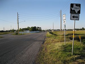 Intersection of FM 1164 and Highway 60 south of East Bernard


See also
References
- ^ a b c Transportation Planning and Programming Division (n.d.). "Farm to Market Road No. 1164". Highway Designation Files. Texas Department of Transportation. Retrieved May 2, 2013.
- ^ "Farm to Market Road 1164" (Map). Google Maps. Retrieved May 2, 2013.
- ^ Hudgins, Merle R. "Handbook of Texas: NOTTAWA, TX". Texas State Historical Association. Retrieved April 30, 2013.