Mêdog Town
This article possibly contains original research. (September 2007) |
Mêdog
མེ་ཏོག་རྫོང་ | |
|---|---|
Town | |
| Tibetan transcription(s) | |
| Chinese transcription(s) | |
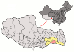
 Location of Mêdog County within Tibet | |
| Coordinates: 29°29′N 95°30′E / 29.483°N 95.500°E | |
| Country | People's Republic of China |
| Region | Tibet |
| Prefecture | Nyingchi Prefecture |
| County seat | Metog |
| Area | |
| • Total | 34,000 km2 (13,000 sq mi) |
| Elevation | 1,500−3,500 m (−10,000 ft) |
| Population (2010 Census) | |
| • Total | 10,963[1] |
| Time zone | UTC+8 (China Standard) |
Mêdog, Metok, or Motuo County (Tibetan: མེ་ཏོག་རྫོང་,, Wylie: Metog Rdzong; simplified Chinese: 墨脱县; traditional Chinese: 墨脫縣; pinyin: Mòtuō Xiàn) Mêdog is a town in the Tibet Autonomous Region of China. Medog town is the seat of Mêdog County, within the administration of Nyingchi Prefecture, Formally called Metok Dzong, it used to be the residence of Dzongpon (district head) representing the authority of Tibetan Lhasa Govt (Ganden Phodrang). Metok town is located within the valley of the great bend of river Tsangpo (Brahmaputra), its elevation is the lowest of all the counties of Tibet hence the town is abundant in vegetation and has rich flora and fauna. Metok is in the heart of Pema ko which connects the county with rest of the country. Majority of Metok population is pemakopas (a.k.a. Pemako Tshangla), with significant minority of khampas, kongpopas and Lhopa.
Metok is in the heart of Pemakö, which connects the county with rest of the country. The majority of Metok population are Pemaköpas speaking Tshangla, with a significant minority of Khambas, Kongpopas and Lhobas.

