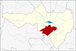
Phayuha Khiri district
Phayuha Khiri
พยุหะคีรี | |
|---|---|
 District location in Nakhon Sawan Province | |
| Coordinates: 15°29′14″N 100°8′24″E / 15.48722°N 100.14000°E | |
| Country | Thailand |
| Province | Nakhon Sawan |
| Tambon | 11 |
| Muban | 125 |
| Area | |
| • Total | 740.8 km2 (286.0 sq mi) |
| Population (2012) | |
| • Total | 62,508 |
| • Density | 84/km2 (220/sq mi) |
| Time zone | UTC+7 (ICT) |
| Postal code | 60130 |
| Geocode | 6010 |
Phayuha Khiri (Thai: พยุหะคีรี, pronounced [pʰā.jú.hàʔ kʰīː.rīː]) is a district (amphoe) in Nakhon Sawan Province, central Thailand.
History
Phayuha Khiri is an ancient city. It was at the midpoint of two larger cities, Phra Bang (today Nakhon Sawan) and Chainat Buri (today Chai Nat), the standard military route used by troops of Sukhothai and Ayutthaya.[citation needed]
Recently the district office was relocated to Tambon Sa Thale.
Its name "Phayuha Khiri" meaning "procession of the mountains", since the area consists of many small and large hills. Some hills are beautiful and are home to both temples and Buddha statues on the top.
Geography
Neighbouring districts are (from the north clockwise): Krok Phra, Mueang Nakhon Sawan, Tha Tako, Tak Fa, and Takhli of Nakhon Sawan Province; Manorom of Chai Nat Province; and Mueang Uthai Thani of Uthai Thani Province.
Administration
The district is divided into 11 sub-districts (tambons), which are further subdivided into 125 villages (mubans). There are two sub-district municipalities (thesaban tambon): Phayuha covering parts of tambon Phayuha, and Tha Nam Oi covering tambons Tha Nam Oi and Muang Hak. There are a further nine tambon administrative organizations (TAO).
| No. | Name | Thai | Villages | Pop.[1] |
|---|---|---|---|---|
| 1. | Phayuha | พยุหะ | 9 | 10,851 |
| 2. | Noen Makok | เนินมะกอก | 12 | 5,803 |
| 3. | Nikhom Khao Bo Kaeo | นิคมเขาบ่อแก้ว | 16 | 6,369 |
| 4. | Muang Hak | ม่วงหัก | 10 | 2,299 |
| 5. | Yang Khao | ยางขาว | 9 | 3,907 |
| 6. | Yan Matsi | ย่านมัทรี | 7 | 4,785 |
| 7. | Khao Thong | เขาทอง | 12 | 7,488 |
| 8. | Tha Nam Oi | ท่าน้ำอ้อย | 8 | 2,840 |
| 9. | Nam Song | น้ำทรง | 11 | 6,386 |
| 10. | Khao Kala | เขากะลา | 19 | 8,552 |
| 11. | Sa Thale | สระทะเล | 12 | 3,228 |
References
- ^ "Population statistics 2012". Department of Provincial Administration.
External links
