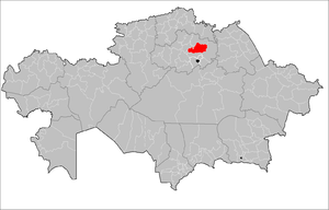
Akkol District
Appearance
Akkol | |
|---|---|
District | |
| Ақкөл ауданы | |
 | |
| Country | |
| Region | Aqmola Region |
| Administrative center | Akkol |
| Founded | 1930 |
| Area | |
| • Total | 3,600 sq mi (9,400 km2) |
| Population (2013)[1] | |
| • Total | 27,522 |
| Time zone | UTC+6 (East) |
Akkol District (Kazakh: Ақкөл ауданы, Aqqól aýdany) is a district (audan) of Aqmola Region in northern Kazakhstan. The administrative center of the district is the town of Akkol. The population at the time of the 2009 Kazakh Census was 28,359.
Communities
- Akkol (Administrative Center)
- Azat
- Bogembay
- Kirovo
- Kvartsitka
- Minskoye
- Stepnogorsk
- Urupinka
References
- ^ "Archived copy". Archived from the original on 2011-05-28. Retrieved 2010-05-13.
{{cite web}}: CS1 maint: archived copy as title (link)
52°00′N 70°56′E / 52.000°N 70.933°E


