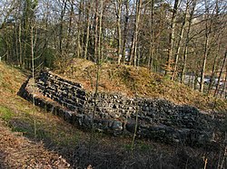
Glanzenberg Castle
Appearance
| Glanzenberg Castle | |
|---|---|
Burg Fahr | |
| Unterengstringen | |
 Glanzenberg Castle in 2010 | |
| Coordinates | 47°24′08″N 8°25′20″E / 47.40217°N 8.42214°E |
| Type | lowland castle |
| Code | CH-ZH |
| Area | 180 m × 45 m–110 m (591 ft × 148 ft–361 ft) |
| Height | 399 m above the sea |
| Site information | |
| Condition | ruin |
| Site history | |
| Built | about 1044 (Burg Fahr) about 1240 (Glanzenberg) |
| Garrison information | |
| Occupants | Freiadlige |

Glanzenberg Castle (German: Burg Glanzenberg or Ruine Glanzenberg) is a ruined castle in the municipality of Unterengstringen in the Swiss canton of Zurich. It is a Swiss heritage site of national significance.[1]
See also
References
- ^ "Kantonsliste A-Objekte". KGS Inventar (in German). Federal Office of Civil Protection. 2009. Archived from the original on 28 June 2010. Retrieved 25 April 2011.
External links
 Media related to Burg Glanzenberg at Wikimedia Commons


