Komna
Appearance

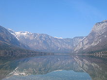
Komna is a mountain karst plateau in the Julian Alps in northwestern Slovenia. It has an elevation from 1,300 metres (4,300 ft) to 1,750 metres (5,740 ft). It has a triangular shape and rises above the Bohinj Basin. To the east, it continues into the Triglav Lakes Valley.[1] The lowest measured temperatures in Slovenia were recorded at Komna in January 2009, reaching −49 °C (−56 °F).[2]
The Komna Lodge is situated on Komna at an elevation of 1,520 metres (4,990 ft). It is operated by the Ljubljana Matica Alpine Club.[3]
References
- ^ Marjan, Javornik; Dermastia, Alenka, eds. (1991). "Komna". Enciklopedija Slovenije [Encyclopedia of Slovenia] (in Slovenian). Mladinska knjiga. p. 213.
- ^ "Slovenski vremenski rekordi" [Slovenian Weather Records] (PDF) (in Slovenian). Environmental Agency of the Republic of Slovenia. 26 October 2010. Archived from the original (PDF) on 4 March 2016.
- ^ Grabrijan, Edo (28 June 2004). "Popotresna obnova Doma na Komni" [The Renovation of the Komna Mountain Hut After the Earthquake]. Gore-ljudje (in Slovenian).
External links
 Media related to Komna at Wikimedia Commons
