
Axial, Colorado
Axial is an extinct town in Moffat County, in the U.S. state of Colorado. The GNIS classifies it as a populated place.[1]
A post office called Axial was established in 1890, and remained in operation until 1958.[2] The community's central location near the "axis" of mining activity caused the name to be selected.[3]
References
- ^ U.S. Geological Survey Geographic Names Information System: Axial, Colorado
- ^ "Post offices". Jim Forte Postal History. Archived from the original on 6 March 2016. Retrieved 23 June 2016.
- ^ Dawson, John Frank (1954). Place names in Colorado: why 700 communities were so named, 150 of Spanish or Indian origin. Denver, CO: The J. Frank Dawson Publishing Co. p. 8.
Municipalities and communities of Moffat County, Colorado, United States | ||
|---|---|---|
| City | 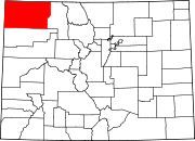 | |
| Town | ||
| CDP | ||
| Unincorporated communities | ||
| Ghost towns | ||
40°17′05″N 107°47′31″W / 40.284823°N 107.791930°W
This Colorado state location article is a stub. You can help Wikipedia by expanding it. |