Route 25 (Iceland)
Appearance
| Route 25 | |
|---|---|
| Þykkvabæjarvegur | |
 | |
| Route information | |
| Length | 18.5 km[1] (11.5 mi) |
| Major junctions | |
| Northern end | |
| Location | |
| Country | Iceland |
| Highway system | |
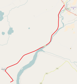
Þykkvabæjarvegur or Route 25 is a national road in the Southern Region of Iceland. It runs from Route 1 near Hella, crosses through Þykkvibær and ends at Suður Nýibær.[1]
References
- ^ "Vegaskrá 2016 - kaflaskipt". Icelandic Road and Coastal Administration. Retrieved 14 May 2017.

