Gyemyeongsan
Appearance
| Gyemyeongsan | |
|---|---|
| Korean name | |
| Hangul | |
| Hanja | |
| Revised Romanization | Gyemyeongsan |
| McCune–Reischauer | Kyemyŏngsan |
| Highest point | |
| Elevation | 774 m (2,539 ft) |
| Coordinates | 36°59′24″N 127°58′37″E / 36.990°N 127.977°E |
| Geography | |
| Location | Chungju, South Korea |
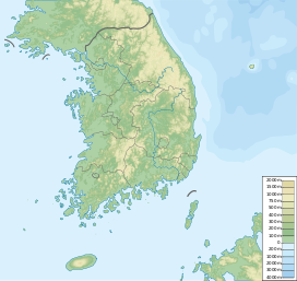
Gyemyeongsan is a mountain located in Chungju, North Chungcheong Province, South Korea. It has an elevation of 774 m (2,539 ft).[1]
Mount Gyemyeongsan guards the city of Chungju, and it is known for its beauty with its impressively-shaped Ambong Peaks.
The park at Mount Gyemyeong sticks out toward Lake Chungju like a fist. This little mountaintop is known as Mount Simhang. Jongdaengi-gil is a forest road that circles Mount Simhang. [2]
See also
- Geography of Korea
- List of mountains in Korea
- List of mountains by elevation
- Mountain portal
- South Korea portal
References
- ^ "산이 보약이다' 충주 계명산 산행". OhmyNews. 15 March 2012. Retrieved 9 July 2013.
- ^ "Hidden trails that highlight Korean beauty". Korea JoongAng Daily. Retrieved 2018-05-25.

