
Jaczków
Jaczków | |
|---|---|
Village | |
 Our Lady of Cestochowa church | |
 Jaczków | |
| Coordinates: 50°48′27″N 16°05′47″E / 50.80750°N 16.09639°E | |
| Country | |
| Voivodeship | Lower Silesian |
| County | Wałbrzych |
| Gmina | Czarny Bór |
Jaczków [ˈjat͡ʂkuf] (German: Hartmannsdorf) a village in Poland located in Lower Silesian Voivodeship, in wałbrzyskim say, in the village commune Czarny Bor.[1] The village is situated on the river Leske, in a valley located between the massif Trójgarbu and Krąglaka the north and the rocky mountains in the south. It lies approximately 6 kilometres (4 mi) north-west of Czarny Bór, 14 km (9 mi) west of Wałbrzych, and 75 km (47 mi) south-west of the regional capital Wrocław.
Demography
The village has about 489 inhabitants. Although the land in the village and municipality is primarily assigned for agriculture,[citation needed] agriculture accounts for just 20% of employment within the population.[citation needed] Most people work in industry and services in nearby Kamienna Góra and Walbrzych. The unemployment rate remains relatively high at around 25-30%.[citation needed]
Economy
In the village there are 2 small shops, a sawmill, workshop and several car transport companies.
Transportation
The village is situated on a rail route linking Jelenia Gora Wałbrzych and Wrocław. Currently this line is in a bad condition.[citation needed] Travel from Wroclaw to Witków nearby (97 km) takes around 2 and a half hours. Also, a network of municipal and county roads located within the miejscwości are in a bad state of repair.[citation needed] In the years 2009-2012 it was intended to express the construction of roads Szczecin - Lubawka to beja near fluent Jaczków (just above the road linking Gostków to Jaczków).[needs update] For the purpose of road construction S3 plan to tunnel under the eastern part of the Massif Krąglaka, at the outlet location to which the emergence of the so-called travel service. ILO Jaczków, then the path will go right behind the village, where more than 300-meter valley Lesku wharf. In the period 2010-2013 is planned construction of sanitary sewers and the construction of the reservoir on the river przeciwpowodziowego Leska.[citation needed]
Points of interest
- Church p.w. sub - Our Lady of Czestochowa from 1586 onwards
- Cemetery and Parish przykościelny
- Manor No 67
- Oficyna Dworska - Apartment in a team office court
- Team Obora court
- Park manor
- House No 68
Administration
In the years 1975-1998, the town administratively belonged to the Wałbrzyskiego province.
Notable residents
- Ernst Christoph von Nassau (1686—1755), Prussian general
- Kazimierz Lipień - Polish wrestler
- Joseph Lipień - Polish wrestler
Gallery
-
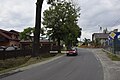 Street with a car
 -
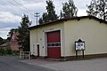 Fire station
 -
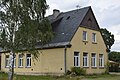 House
House
_jar.jpg)
_jar.jpg)
_jar.jpg)
References
| Seat |  | |
|---|---|---|
| Other villages | ||