Roodeplaat Nature Reserve
Appearance
| Roodeplaat Nature Reserve | |
|---|---|
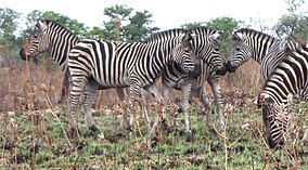
 Common zebra at Roodeplaat Nature Reserve | |
| Location | South Africa |
| Nearest city | Pretoria |
| Coordinates | 25°39′00″S 28°21′44″E / 25.65000°S 28.36222°E |
| Area | 1,555 hectares (15.55 km2)[1] |
| Established | 1977[2] |
| Governing body | Gauteng Department of Agriculture and Rural Development |
Roodeplaat (Dam Provincial) Nature Reserve is located on the shores of the Roodeplaat Dam, 22 km north-east of Pretoria, Gauteng.
In 1972 the Department of Water Affairs and Forestry (DWAF) delegated the management of the Roodeplaat Dam area to the Nature Conservation division of the Transvaal Provincial Administration (TPA). Their mandate was to develop the area as a nature reserve and outdoor recreation facility for Pretoria's residents. The reserve was proclaimed in 1977.
See also
Notes
- ^ "Overview of Roodeplaat Dam". Terrestrial Ecosystem Monitoring. European Communities. Archived from the original on 7 January 2009. Retrieved 25 November 2008.
- ^ "Roodeplaat Dam". Roodeplaat-Reserve.co.za. Retrieved 25 November 2008.
External links
![]() Media related to Roodeplaat Nature Reserve at Wikimedia Commons
Media related to Roodeplaat Nature Reserve at Wikimedia Commons
- Roodeplaat Dam Nature Reserve - Ecological Management Plan, August 2007, Gauteng Department of Agriculture, Conservation, Environment and Land Affairs
- Unofficial Guide to the Reserve
- Roodeplaat info at Southern African Birding

