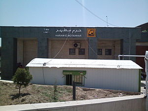
Haram-e Motahhar-e Emam Khomeini Metro Station
Appearance
| Tehran Metro Station | |||||||||||
 | |||||||||||
| General information | |||||||||||
| Location | Behesht-e Zahra, Tehran County Iran | ||||||||||
| Coordinates | 35°32′42.38″N 51°22′22.74″E / 35.5451056°N 51.3729833°E | ||||||||||
| Operated by | Tehran Urban and Suburban Railways Organization (Metro) | ||||||||||
| Platforms | 2 Side Platforms | ||||||||||
| Tracks | 2 | ||||||||||
| Connections |
| ||||||||||
| Construction | |||||||||||
| Structure type | Underground | ||||||||||
| Depth | Shallow | ||||||||||
| Parking | Yes | ||||||||||
| Bicycle facilities | Yes | ||||||||||
| History | |||||||||||
| Opened | 1382 H-Sh (2003) | ||||||||||
| Services | |||||||||||
| |||||||||||
Haram-e Motahhar-e Emam Khomeini Metro station, formerly simply called Haram-e Motahhar Metro Station, is a station of Tehran Metro Line 1.[1] The next station is Shahed on the north side and Kahrizak on the south side. It is located east of Mausoleum of Khomeini.
References
- ^ "نقشه مترو". metro.tehran.ir. Retrieved 2019-11-02.

