Jump to content

Dębowa Góra, Warmian-Masurian Voivodeship

Coordinates: 53°31′25″N 20°14′12″E / 53.52361°N 20.23667°E / 53.52361; 20.23667
From Wikipedia, the free encyclopedia

This is an old revision of this page, as edited by Xx78900 (talk | contribs) at 09:33, 12 November 2019 (Added a map and changed the link of "Warmian-Masurian Voivodeship" from linking to the article of the same name, to having "Warmian-Masurian" link to said article, and "Voivodeship" link to the page describing those generally.). The present address (URL) is a permanent link to this revision, which may differ significantly from the current revision.

Dębowa Góra
Village
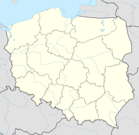
Dębowa Góra is in Northern Poland, slightly to the East
Dębowa Góra
Location of Dębowa Góra in Poland
CountryPoland Poland
VoivodeshipWarmian-Masurian
CountyOlsztyn County
GminaOlsztynek

Dębowa Góra [dɛmˈbɔva ˈɡura] (German: Eichberg) is a village in the administrative district of Gmina Olsztynek, within Olsztyn County, Warmian-Masurian Voivodeship, in northern Poland.[1]

Before 1945 the area was part of Germany (East Prussia).

References

  1. ^ "Central Statistical Office (GUS) - TERYT (National Register of Territorial Land Apportionment Journal)" (in Polish). 2008-06-01.


53°31′25″N 20°14′12″E / 53.52361°N 20.23667°E / 53.52361; 20.23667