
Radzimów
Radzimów | |
|---|---|
Village | |
.jpg) | |
 Radzimów  Radzimów | |
| Coordinates: 51°3′N 15°7′E / 51.050°N 15.117°E | |
| Country | |
| Voivodeship | |
| County | Zgorzelec |
| Gmina | Sulików |
| Population | 784 |
Radzimów [raˈd͡ʑimuf] (German: Bellmannsdorf) is a village in the administrative district of Gmina Sulików, within Zgorzelec County, Lower Silesian Voivodeship, in south-western Poland, close to the Czech border.[1]
It lies approximately 5 kilometres (3 mi) south-east of Sulików, 14 kilometres (9 mi) south-east of Zgorzelec, and 135 kilometres (84 mi) west of the regional capital Wrocław.
The village has a population of 784.
-
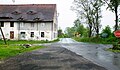 Crossroads
 -
 Toilet
 -
 House
House
.jpg)
_(1).jpg)
.jpg)
Notable residents
- Moritz von Bissing (1844–1917), Prussian General
References
Wikimedia Commons has media related to Radzimów.
This Zgorzelec County location article is a stub. You can help Wikipedia by expanding it. |