
Lutogniewice
Lutogniewice | |
|---|---|
Village | |
 Half-timbered house | |
 Lutogniewice  Lutogniewice | |
| Coordinates: 51°00′29″N 14°58′3″E / 51.00806°N 14.96750°E | |
| Country | |
| Voivodeship | Lower Silesian |
| County | Zgorzelec |
| Gmina | Bogatynia |
| Population | 218 |
Lutogniewice [lutɔɡɲɛˈvit͡sɛ] (German: Schönfeld) is a village in the administrative district of Gmina Bogatynia, within Zgorzelec County, Lower Silesian Voivodeship, in south-western Poland, close to the Czech and German borders.[1] Prior to 1945 it was in Germany.
It lies approximately 11 kilometres (7 mi) north of Bogatynia, 17 km (11 mi) south of Zgorzelec, and 146 km (91 mi) west of the regional capital Wrocław.
Gallery
-
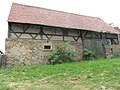 Barn
Barn -
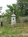 Wayside cross
 -
 Bus stop
.jpg)
.jpg)

References
Wikimedia Commons has media related to Lutogniewice.
| Town and seat |  | |
|---|---|---|
| Villages | ||
This Zgorzelec County location article is a stub. You can help Wikipedia by expanding it. |