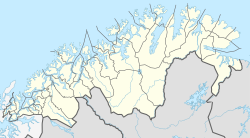
Alapmoen
Appearance
Alappmoen
Alapmoen | |
|---|---|
Village | |
| Coordinates: 68°59′49″N 19°02′00″E / 68.9969°N 19.0332°E | |
| Country | Norway |
| Region | Northern Norway |
| County | Troms og Finnmark |
| District | Midt-Troms |
| Municipality | Målselv Municipality |
| Elevation | 84 m (276 ft) |
| Time zone | UTC+01:00 (CET) |
| • Summer (DST) | UTC+02:00 (CEST) |
| Post Code | 9334 Øverbygd |
Alappmoen or Alapmoen is a small farming village in Målselv Municipality in Troms og Finnmark county, Norway. The village is located about 1 kilometre (0.62 mi) south of the Målselva river and about 21.5 km (13.4 mi) southeast of the urban area of Bardufoss, and about 11 km (6.8 mi) southwest of the village of Skjold.
The location of Alappmoen is unusual since it a small cluster of farming fields in the middle of a forest in Northern Norway which is unlike most other communities in Norway, since they are located near the ocean or along a river. The little farms of Rolvsjord, Skog, Frostad, and Renmelmoen are included in the village area.
References
- ^ "Alapmoen, Målselv (Troms)". yr.no. Retrieved 2018-08-19.
External links


