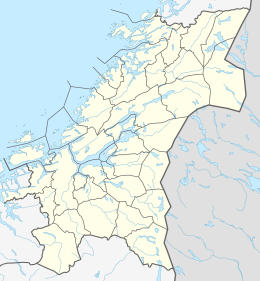
Borgan, Norway
Appearance
 | |
| Geography | |
|---|---|
| Location | Trøndelag, Norway |
| Coordinates | 64°58′33″N 10°54′15″E / 64.9758°N 10.9043°E |
| Area | 6.2 km2 (2.4 sq mi) |
| Length | 5 km (3.1 mi) |
| Width | 2 km (1.2 mi) |
| Highest elevation | 89 m (292 ft) |
| Highest point | Trollskardstindan |
| Administration | |
Norway | |
| County | Trøndelag |
| Municipality | Nærøysund |
Borgan is an island in Nærøysund municipality in Trøndelag county, Norway. The 6.2-square-kilometre (2.4 sq mi) island lies about 3 kilometres (1.9 mi) north of the larger island of Ytter-Vikna and the island of Kalvøya lies immediately north of Borgan.[1]
Borgan is not accessible by road, but there is a ferry connection to Ramstadlandet on Ytter-Vikna. Most of the island's residents live on the south side of the island. The highest point on the island is the 89-metre (292 ft) tall Trollskardstindan.[1]
See also
References
- ^ a b Thorsnæs, Geir, ed. (2017-12-25). "Borgan". Store norske leksikon (in Norwegian). Kunnskapsforlaget. Retrieved 2018-05-05.


