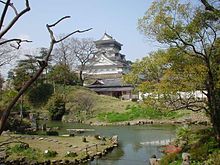
Kokura Domain

Kokura Domain (小倉藩, Kokura-han)', also known as "Kawara-han" (香春藩) or then "Toyotsu-han" (豊津藩), was a Japanese domain of the Edo period. It was associated with Buzen Province in modern-day Fukuoka Prefecture on the island of Kyushu.
In the han system, Kokura was a political and economic abstraction based on periodic cadastral surveys and projected agricultural yields.[1] In other words, the domain was defined in terms of kokudaka, not land area.[2] This was different from the feudalism of the West.
List of daimyōs
The hereditary daimyōs were head of the clan and head of the domain.
![]() Hosokawa clan, 1600–1632 (tozama; 399,000 koku)
Hosokawa clan, 1600–1632 (tozama; 399,000 koku)
![]() Ogasawara clan, 1632–1871 (fudai; 150,000 koku)
Ogasawara clan, 1632–1871 (fudai; 150,000 koku)
See also
References

- ^ Mass, Jeffrey P. and William B. Hauser. (1987). The Bakufu in Japanese History, p. 150.
- ^ Elison, George and Bardwell L. Smith (1987). Warlords, Artists, & Commoners: Japan in the Sixteenth Century, p. 18.
External links
![]() Media related to Kokura Castle at Wikimedia Commons
Media related to Kokura Castle at Wikimedia Commons
- (in Japanese) Kokura on "Edo 300 HTML" (9 Oct. 2007)
