Jarčje Brdo
Appearance
Jarčje Brdo | |
|---|---|
| Coordinates: 46°10′34.35″N 14°12′18.5″E / 46.1762083°N 14.205139°E | |
| Country | |
| Traditional region | Upper Carniola |
| Statistical region | Upper Carniola |
| Municipality | Gorenja Vas–Poljane |
| Area | |
| • Total | 1.05 km2 (0.41 sq mi) |
| Elevation | 664.4 m (2,179.8 ft) |
| Population (2002) | |
| • Total | 23 |
| [1] | |
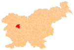
Jarčje Brdo (pronounced [ˈjaːɾtʃjɛ ˈbəɾdɔ]; in older sources also Jarče Brdo,[2] German: Jartschinberdo[2]) is a dispersed settlement in the hills between the Selca Sora and the Poljane Sora valleys in the Municipality of Gorenja Vas–Poljane in the Upper Carniola region of Slovenia.[3]
The local church is dedicated to Saint Valentine. It was built between 1854 and 1857 on the site of an earlier church and has a triple nave. The belfry from the earlier church, dating to 1728, is preserved.[4]
References
- ^ Statistical Office of the Republic of Slovenia
- ^ a b Leksikon občin kraljestev in dežel zastopanih v državnem zboru, vol. 6: Kranjsko. 1906. Vienna: C. Kr. Dvorna in Državna Tiskarna, p. 58.
- ^ Gorenja Vas–Poljane municipal site
- ^ Official Journal of the Republic of Slovenia, No 14/2004, 13. Feb. 2004, declaring the church a cultural monument of local interest(in Slovene)
External links


