Odiel
| Odiel River | |
|---|---|
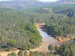
 View of the Odiel River | |
 | |
| Location | |
| Country | Spain |
| Physical characteristics | |
| Source | |
| • location | Sierra de Aracena |
| • elevation | 660 metres (2,170 ft) |
| Mouth | |
• location | Huelva Estuary |
• elevation | 0 metres (0 ft) |
| Basin size | Tinto - Odiel |


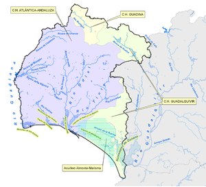
The Odiel (Template:Lang-es) is a river in the Atlantic basin in southern Spain, more precisely in the province of Huelva, Andalusia. It originates at Marimateos in the Sierra de Aracena at an elevation of 660 metres (2,170 ft) above sea level. At the Punta del Sebo, it joins the Rio Tinto to form the Huelva Estuary. Its principal tributaries are the Escalada, Meca, Olivargas, Oraque, Santa Eulalia, and El Villar. Its basin covers 990 square kilometres (380 sq mi).
In Roman times it was known as the Luxia.[1] Even before the Romans, its mouth was an important place of commerce, as can be seen by archaeological remnants from Phoenicians and Ancient Greeks, known as the "Huelva Estuary Deposit" (Template:Lang-es), dated 1000 BCE.[2]
See also
Notes
- ^ Johann Georg Theodor Grässe, Orbis Latinus, 2nd ed. Berlin: Schmidt / New York: Steiger, 1909, OCLC 1301238 (in German) (online).
- ^ Depósito de la ría Archived 2010-03-27 at the Wayback Machine, Arte e historia. Accessed online 2009-12-24.
37°16′15″N 6°57′53″W / 37.27083°N 6.96472°W
