Kanižarica
Kanižarica | |
|---|---|
 | |
| Coordinates: 45°33′38.75″N 15°10′2.19″E / 45.5607639°N 15.1672750°E | |
| Country | |
| Traditional region | White Carniola |
| Statistical region | Southeast Slovenia |
| Municipality | Črnomelj |
| Area | |
| • Total | 1.69 km2 (0.65 sq mi) |
| Elevation | 152.8 m (501.3 ft) |
| Population (2002) | |
| • Total | 569 |
| [1] | |
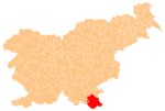
Kanižarica (pronounced [kaˈniːʒaɾitsa]) is a settlement southwest of the town of Črnomelj in the White Carniola area of southeastern Slovenia. The area is part of the traditional region of Lower Carniola and is now included in the Southeast Slovenia Statistical Region.[2]
History
During the Second World War, on 19 July 1942, the Partisan White Carniola Detachment took 61 Roma from Kanižarica. They were marched to Mavrlen, which had recently been emptied of its Gottschee German residents, held prisoner there for two days, and then murdered and buried in the Zagradec Mass Grave (Template:Lang-sl) southeast of the abandoned settlement of Gradec, now part of the settlement of Rožič Vrh.[3][4][5]
Coal mine
A coal mine in the settlement that began in 1857 and was closed 1995 is partly preserved. The main mine shaft has been filled in, but the headframe and administrative buildings remain and some of the original mining equipment is displayed in a reconstructed shaft.[6]
References
- ^ Statistical Office of the Republic of Slovenia
- ^ Črnomelj municipal site
- ^ "Genocid nad Cigani na Blokah in v Iški." 2010. Zaveza 43 (25 February). Archived 2012-12-25 at the Wayback Machine (in Slovene)
- ^ Polič, Radko. 1975. Belokranjski odred. Ljubljana: Partizanska knjiga, p. 238.
- ^ Zagradec Mass Grave on Geopedia (in Slovene)
- ^ Slovenian Ministry of Culture register of national heritage reference number ešd 19941
External links


