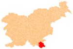
Zastava, Črnomelj
Appearance
Zastava | |
|---|---|
| Coordinates: 45°34′56.71″N 15°14′9.7″E / 45.5824194°N 15.236028°E | |
| Country | |
| Traditional region | White Carniola |
| Statistical region | Southeast Slovenia |
| Municipality | Črnomelj |
| Area | |
• Total | 4.67 km2 (1.80 sq mi) |
| Elevation | 164.7 m (540.4 ft) |
| Population (2020) | |
• Total | 14 |
| • Density | 3.0/km2 (7.8/sq mi) |
| [1] | |
Zastava (pronounced [ˈzaːstaʋa]; German: Sastawa[2]) is a small settlement on the Lahinja River east of Črnomelj in the White Carniola area of southeastern Slovenia. The area is part of the traditional region of Lower Carniola and is now included in the Southeast Slovenia Statistical Region.[3]
References
[edit]- ^ Statistical Office of the Republic of Slovenia Archived November 18, 2008, at the Wayback Machine
- ^ Leksikon občin kraljestev in dežel zastopanih v državnem zboru, vol. 6: Kranjsko. 1906. Vienna: C. Kr. Dvorna in Državna Tiskarna, p. 6.
- ^ Črnomelj municipal site
External links
[edit]


