Vinkebrug

Coordinates: 52°23′N 4°43′E / 52.383°N 4.717°E / 52.383; 4.717
From Wikipedia, the free encyclopedia

This is the current revision of this page, as edited by Ohnoitsjamie (talk | contribs) at 21:10, 7 January 2020 (Reverted edits by Betudidntusethisname (talk) to last version by Thayts). The present address (URL) is a permanent link to this version.

(diff) ← Previous revision | Latest revision (diff) | Newer revision → (diff)

52°23′N 4°43′E / 52.383°N 4.717°E / 52.383; 4.717

Vinkebrug
hamlet
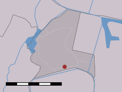
Location of Vinkebrug
CountryNetherlands
ProvinceNorth Holland
MunicipalityHaarlemmermeer

Vinkebrug is a hamlet in the Dutch province of North Holland. It is a part of the municipality of Haarlemmermeer and lies about 6 km (3.7 mi) east of Haarlem.[1]

References[edit]

  1. ^ ANWB Topografische Atlas Nederland, Topografische Dienst and ANWB, 2005.