
Belleserre
Belleserre | |
|---|---|
 | |
.svg) Coat of arms | |
Location of Belleserre  | |
 Belleserre  Belleserre | |
| Coordinates: 43°29′27″N 2°03′22″E / 43.4908°N 2.0561°E | |
| Country | France |
| Region | Occitania |
| Department | Tarn |
| Arrondissement | Castres |
| Canton | La Montagne noire |
| Intercommunality | Pays de Dourgne |
| Government | |
| • Mayor (2008–2014) | Jean-Marie Petit |
| Area 1 | 4.76 km2 (1.84 sq mi) |
| Population (2021)[1] | 161 |
| • Density | 34/km2 (88/sq mi) |
| Time zone | UTC+01:00 (CET) |
| • Summer (DST) | UTC+02:00 (CEST) |
| INSEE/Postal code | 81027 /81540 |
| Elevation | 187–246 m (614–807 ft) (avg. 300 m or 980 ft) |
| 1 French Land Register data, which excludes lakes, ponds, glaciers > 1 km2 (0.386 sq mi or 247 acres) and river estuaries. | |
Belleserre is a commune in the Tarn department in southern France.
Monuments
-
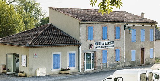 The town hall.
 -
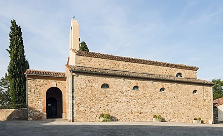 The church.
 -
 The War Memorial


See also
References
- ^ "Populations légales 2021". The National Institute of Statistics and Economic Studies. 28 December 2023.
Wikimedia Commons has media related to Belleserre.
| Authority control databases: National |
|---|
This Tarn geographical article is a stub. You can help Wikipedia by expanding it. |