Heath River
Appearance
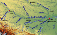
The Heath River, which runs from the Andes surrounding Lake Titicaca northwards to the Madre de Dios River, marks the natural border between Peru and Bolivia.

The Eja Sonene indigenous community lives in the area. They are an ethnic group belonging to either the Tacana-speaking Arawak, who migrated from the west or those of Pano origin, who originate from the lower reaches of the Madeira River.
Named for explorer Dr. Edwin R. Heath in the 1880s, the river borders lowland savannah and rainforest. [1] An early expedition to explore the Heath River basin was led by Colonel Percy Harrison Fawcett in 1910. [2]
References
- ^ "Heath River Wildlife Center with GreenTracks". www.greentracks.com. Retrieved 2020-01-03.
- ^ "Colonel Percy Harrison Fawcett". heathriverexpedition. Retrieved 2020-01-03.
External links
12°50′00″S 68°50′10″W / 12.8333°S 68.8361°W
