Lignéville
Lignéville | |
|---|---|
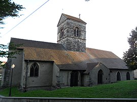
 The church in Lignéville | |
| Coordinates: 48°10′00″N 5°57′07″E / 48.1667°N 5.9519°E | |
| Country | France |
| Region | Grand Est |
| Department | Vosges |
| Arrondissement | Neufchâteau |
| Canton | Vittel |
| Intercommunality | Vosges Côté Sud-Ouest |
| Government | |
| • Mayor (2014-2020) | Gilbert Bogard |
| Area 1 | 12.53 km2 (4.84 sq mi) |
| Population (2017) | 315 |
| • Density | 25/km2 (65/sq mi) |
| Time zone | UTC+01:00 (CET) |
| • Summer (DST) | UTC+02:00 (CEST) |
| INSEE/Postal code | 88271 /88800 |
| Elevation | 362–457 m (1,188–1,499 ft) (avg. 410 m or 1,350 ft) |
| 1 French Land Register data, which excludes lakes, ponds, glaciers > 1 km2 (0.386 sq mi or 247 acres) and river estuaries. | |
Lignéville is a commune in the Vosges department in Grand Est in northeastern France.
Population
| Year | Pop. | ±% |
|---|---|---|
| 2005 | 300 | — |
| 2006 | 298 | −0.7% |
| 2007 | 295 | −1.0% |
| 2008 | 295 | +0.0% |
| 2009 | 301 | +2.0% |
| 2010 | 308 | +2.3% |
| 2011 | 314 | +1.9% |
| 2012 | 320 | +1.9% |
| 2013 | 318 | −0.6% |
| 2014 | 315 | −0.9% |
| 2015 | 313 | −0.6% |
| 2016 | 316 | +1.0% |
| 2017 | 315 | −0.3% |
Politics
Presidential Elections Second Round:[1]
| Election | Winning Candidate | Party | % | |
|---|---|---|---|---|
| style="background-color: Template:National Front (France)/meta/color" | | 2017 | Marine Le Pen | FN | 55.97 |
| style="background-color: Template:Socialist Party (France)/meta/color" | | 2012 | François Hollande | PS | 51.83 |
| style="background-color: Template:Socialist Party (France)/meta/color" | | 2007 | Ségolène Royal | PS | 50.52 |
| style="background-color: Template:Rally for the Republic/meta/color" | | 2002 | Jacques Chirac | RPR | 76.73 |
See also
References
Wikimedia Commons has media related to Lignéville.


